
Or “We’re Really Luck To Live Here”
We live not far from the north shore of Lake Erie, in Ontario, Canada.
We haven’t always lived here, or indeed in Canada, and that is perhaps what helps us appreciate what a lovely place it is to live. Certainly it’s not exciting, there are no high mountains (or even hills!), or deep valleys, but it is bucolic, and pleasantly so.
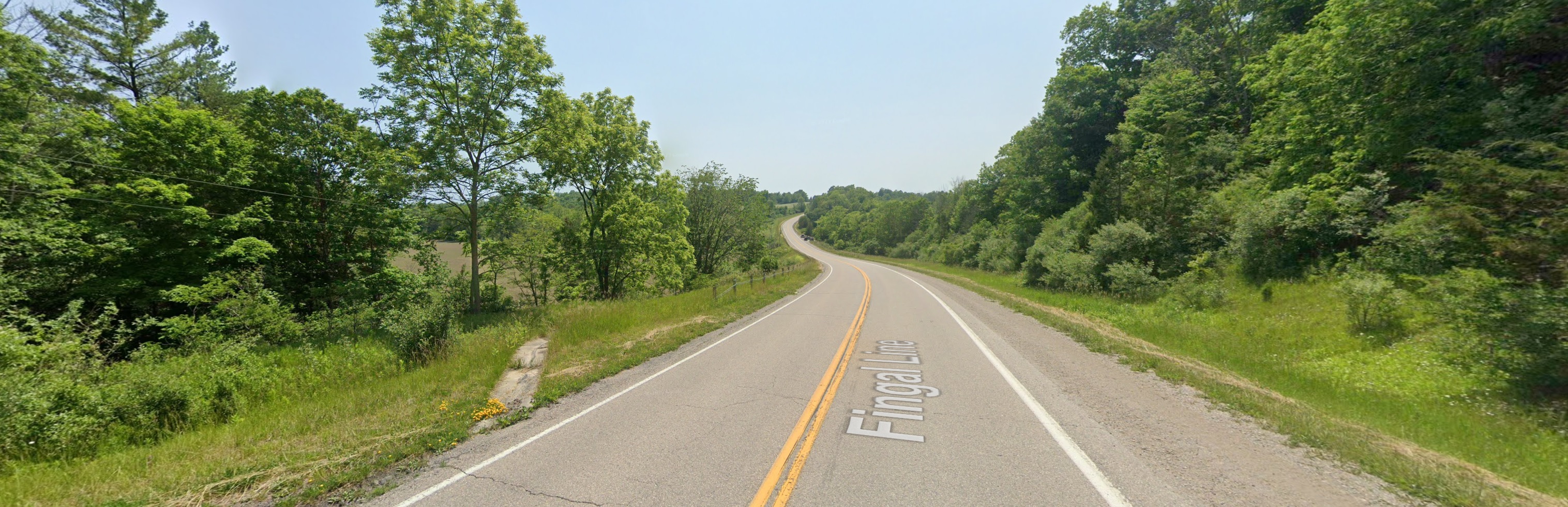
We drove along the old Talbot Trail for a while, one of those ruler straight roads built by the settlers to allow both access to land, and to get from Lake Ontario to Windsor and Detroit. Because it’s been superseded by the 401 freeway, it’s a very quiet road and you can drive for ages without seeing another vehicle, and yet it’s wide and well surfaced. We use it in preference to the freeway if we’re not in a hurry, and it’s to be recommended for easing your blood pressure. The road links some of the old farming communities; Blenheim, Guilds, Morpeth, Palmyra, Eagle, and Wallacetown, to name but a few. It was in Wallacetown that we took a dive south and followed Fingal Line for a few miles, and that it is even quieter than the Talbot Trail. It also has a few dips and turns as it negotiates some of the valleys scored into the soft land that’s close to the lake, to give some nice relief from the flat and straight of the land further west.
All along this lake-side, east-west route, is intensively farmed land, with Corn and Soy Beans stretching as far as the eye can see. At the westerly end of Talbot Trail, there are far fewer trees and far larger fields, but that vista gives way to more trees and smaller fields as you move eastwards. Because it’s an old road, it’s lined with many mature trees, some native to the area, some not, but as this trip was on the last day of September, most were beginning to turn for winter, with yellow, red and brown showing up in among the green. It may not be as spectacular as Algonquin, but in this more gentle countryside it looked fabulous on a sun-drenched day.
The roadside ditches are filled with Asters, Goldenrod, and Sumac, with the remnant of Milkweed still around after their summer bloom. Despite the heavily farmed fields, it seems that the native plants are not going away, and that pleases me.
Of course all that I have described is the post-Contact world, tamed by generations of European settlers. Pre-Contact, the entire area would have been wooded, mostly Carolinian Forest along the lake’s edge, and populated with native people. They had their own routes to travel, of course, naturally made and never using a ruler on a map. It would be wrong of me not to acknowledge that, and of the treaties broken by successive groups of incomers that took the land from its native population, broken by the people who drew those straight lines and cleared the forests. We can’t go back, but we can accept that we Europeans are recent interlopers and really do not own the land, despite what the maps say. It’s fitting to note that we drove this trip on September 30th, National Truth and Reconciliation in Canada, and did acknowledge our presence on stolen land.
